

-
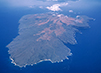
Canoe Paddling off the coast of Kanaloa Kaho‘olawe, ca. 1987
Courtesy Franco Salmoiraghi
Migrating voyagers from the South Pacific began to settle on Kanaloa Kaho‘olawe, named after Kanaloa, the god of the ocean, around the year 1,000. Over the centuries, the island became home to families of farmers and fishers and developed into a natural observatory for keeping the solar and lunar calendars and a navigational hub for the region. On its second highest point, known as Moa‘ulaiki, voyagers can see all of the islands of Hawai‘i except Kaua‘i and Ni‘ihau, and there is a clear view of the surrounding channels and islands spanning 360 degrees. Contemporary navigators value Kanaloa Kaho‘olawe as a natural planetarium for training.
-
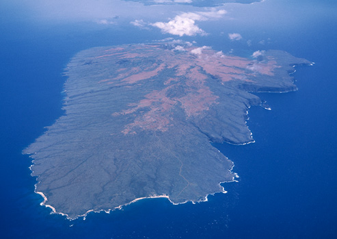
Aerial view of Kanaloa Kaho‘olawe, 1995
Courtesy Franco Salmoiraghi
-
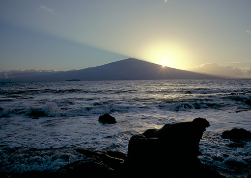
From Hakioawa bay, Kanaloa Kaho‘olawe, looking toward Haleakala Maui at sunrise, 1979
Courtesy Franco Salmoiraghi
Kanaloa Kaho‘olawe lies at the piko or center of the Hawaiian Islands, with Kaua‘i the farthest north and Hawai‘i island the farthest south. At sea level at Lae O Kealaikahiki (point of the pathway to Tahiti), navigators can fix the latitude of the island chain by observing the relative position of the north star and southern cross in relation to the horizon and key constellations, from February through June.
Given the easterly winds, voyagers returning from the South Pacific, travel far east until they are at the latitude of the islands and before heading west to make landfall. When the north star and southern cross appear over the horizon as they do over Kanaloa Kaho‘olawe, then the returning wayfinders know it is time to head west for Hawai‘i.
-
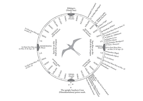
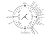
Star compass, 1980
Copyright by C. Nainoa Thompson
This illustration of the Hawaiian Star Compass has a soaring bird enclosed at its center. The compass represents the navigator’s 360 degree view of the ocean horizon. It contains directional information and marks the rising locations of stars, labeled in both Hawaiian and English.